After a morning of seed cleaning followed by a quick lunch in nearby Wilmington, it’s treat time. Since my last walk at South Patrol Road Prairie, there have been a few inches of fresh snowfall. This affords me the opportunity to walk in the footsteps of Aldo Leopold. In “January Thaw,” the first sketch in A Sand County Almanac – the bible, for many preservationists – he describes the joy of following the tracks of various animals in the snow. “January observation can be almost as simple and peaceful as snow, and almost as continuous as cold. There is time not only to see who has done what, but to speculate why.”
And cold it certainly is today, with temperatures in the upper teens and a sharp wind out of the west. The thick skies threaten more snow. The upside of such harsh weather is that there is not another human being to be seen. Not so much, even, as a booted footprint other than my own.
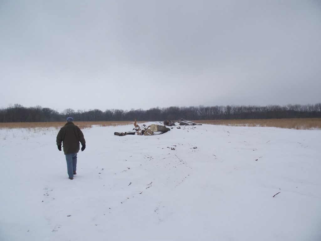
There are plenty of other signs of life, however, along a work road that leads into the heart of the largest restoration are at Midewin. Wide enough to accommodate the heavy equipment that’s lately been used to remove more miles of hedgerows, the snow-covered road lies before me like a book. Criss-crossing the road are mounded, sub-snow tunnels of prairie voles. In healthy environments, there may be as many as several hundred voles per acre. Judging by the number of tunnels, or “runways” as ecologists call them, this prairie restoration looks to be well on its way toward a healthy condition – not a bad accomplishment considering it was fallow farm field a decade ago. Since then, the USDA Forest Service, working in partnership with a number of nonprofit partners including The Wetlands Initiative and Corlands, has spent several years removing miles of drainage tiles, filled drainage ditches, leveled a railroad berm and recontoured a landscape that had been in agricultural production for generations. More than 100,000 prairie “plugs” have been planted, including wild onion which I helped plant by hand last year.
The ensuing patchwork quilt of prairie and wetland communities has provided a good home for our native voles. And our native mice, judging by the similar number of tracks upon the surface of the snow. And while they might be the bane of farmers and homeowners – Google “vole” and most of the front-loaded entries have to do with exterminating them – these native critters are a vital part of the prairie food chain, evidenced by a set of coyote prints. In sharp contrast to the random windings of the vole runways and mice tracks, the coyote prints run in a measured, straight line until they erupt in a concentrated flurry. Over the course of a mile, I come across a dozen such skirmish sites, which makes the road seem more like a buffet line.

And coyotes aren’t the only ones partaking of this mid-winter smorgasbord. Here and there are little splashes of dirt and snow, evidence of some hawk, or what Leopold called “feathered bombs,” dropping out of the sky for a meal. There are several species of hawks that remain year-round at Midewin, but the likely culprits in this treeless, 450-acre expanse are northern harriers. Unlike red-tailed hawks, which typically hunt from the perimeters of such open areas – they prefer elevated perches, such as trees, from which to swoop down and seize prey – northern harriers hunt by gliding slowly above open grasslands. They fly low, relying as much upon sound as sight.
And what a sight they are today, with nearly a dozen on the hunt – more than I’ve seen anywhere else. Another strong indication that this prairie recovery is working. Northern harriers are endangered in Illinois, a victim first of disappearing prairie and wetlands, and more recently of open farm fields giving way to suburban housing developments.
A little further down the path lies what’s left of one of those hedgerows that had to go so that harriers and other grassland-dependent birds could return. Where just a couple of months ago there was an impenetrable tangle of Osage orange trees, Japanese honeysuckle and multi-flora rose – non-native species all – there now remains nothing but a small mountain of mulch. Oh, and a couple dozen stacked trunks of cottonwood trees. The cut trees provide the opportunity to inhabit yet another sketch in A Sand County Almanac. It’s not yet February, I’m not here to saw the trees into firewood, and cottonwood is certainly not “Good Oak,” but I can count tree rings. I can surmise, as did Leopold with his fallen oak, how these cottonwoods came to grow here and use the tree rings as a timeline to chart the changes to the landscape over their lifetimes.
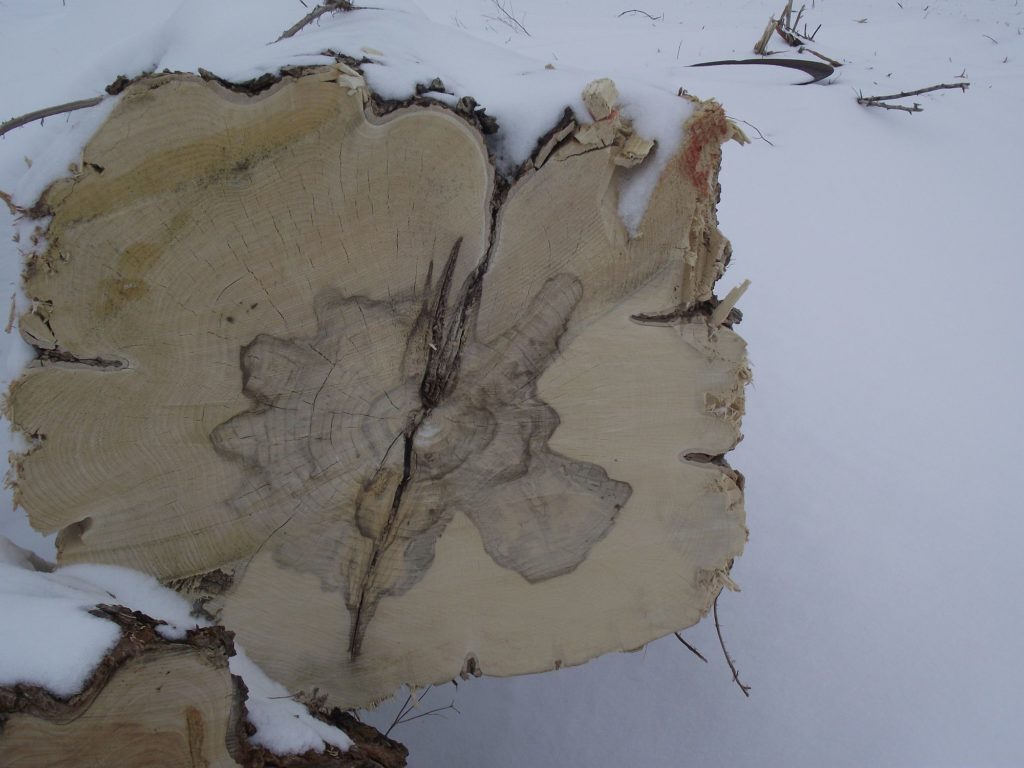
In truth, it’s tough to count tree rings in the soft wood of cottonwood trees, the saw blades having left obscuring scars. But as far as I can tell, most are roughly the same diameter and the most readable examples average 66 rings. That dates them to 1945, five years after the federal government acquired 36,345 acres of farmland to establish the Elwood Ordnance Plant and the Kankakee Ordnance Works, which came to be known collectively as the Joliet Army Ammunition Plant.
The cottonwoods in this hedgerow were likely “volunteers,” with the purposefully planted Osage orange providing a suitable nursery to catch wind-blown seed and harbor seedlings. Before the army took over, farmers likely would have kept the cottonwoods at bay so they didn’t shade or divert water from cropland. During the arsenal years, the army likely let the hedgerows run wild, with adjacent land largely used for the pasturing of cattle, which would have benefited from the shade of tall trees.
As much as I’d love to take an historical sleuthing through all of the tree rings as Leopold did, that biting wind and the start of a stinging snow makes me think better of it. For now.